Workshop - Vltava river valley
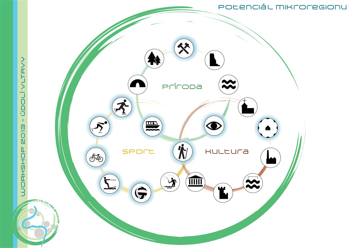
Vltava river valley - landscape of recreation and culture
Principles of design:
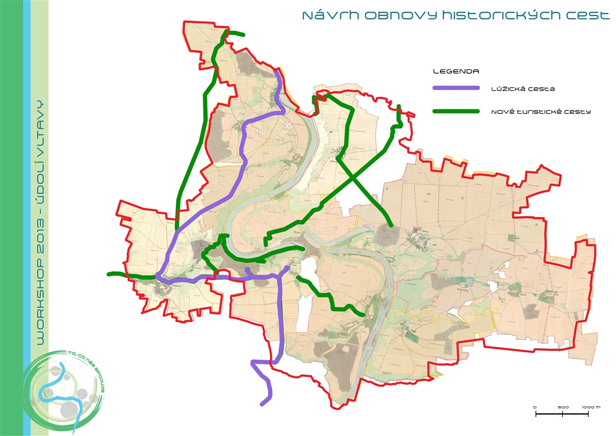
• connection of the plateaus with the deep river valley through restoration of historic paths:
1. the definition of new tourist routes according to historical maps
2. restore important historic route: Lusatian trail (in czech Lužická stezka)
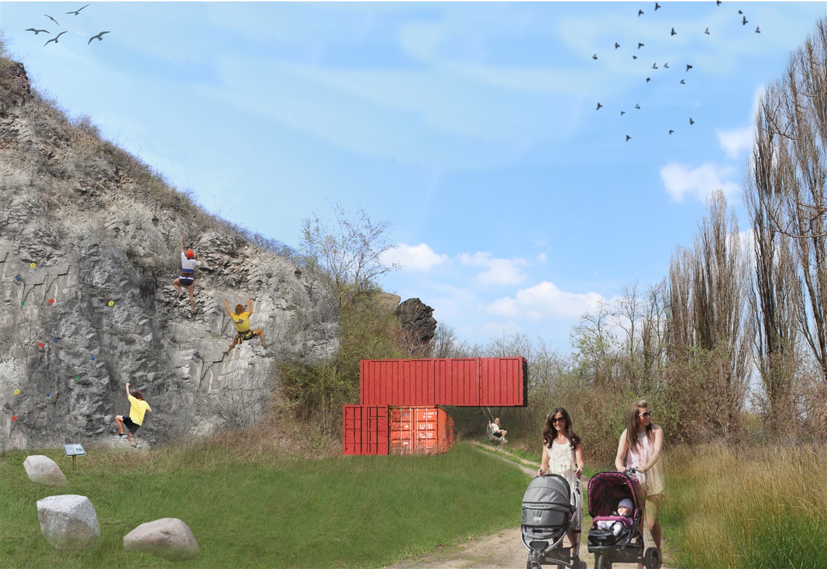
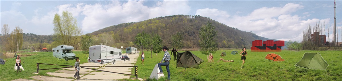
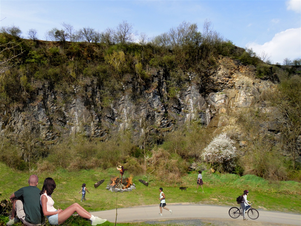
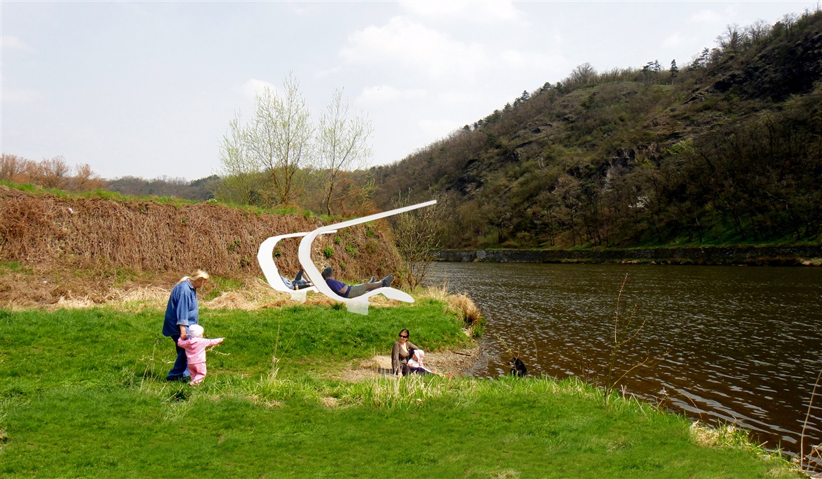
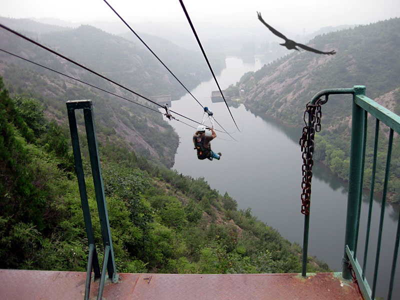
• the use and development of the recreational potential of riverbanks:
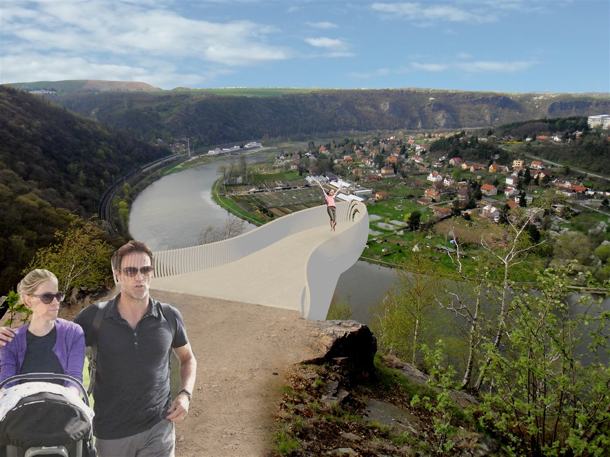
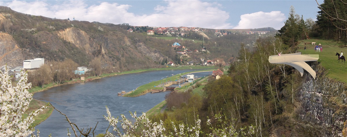
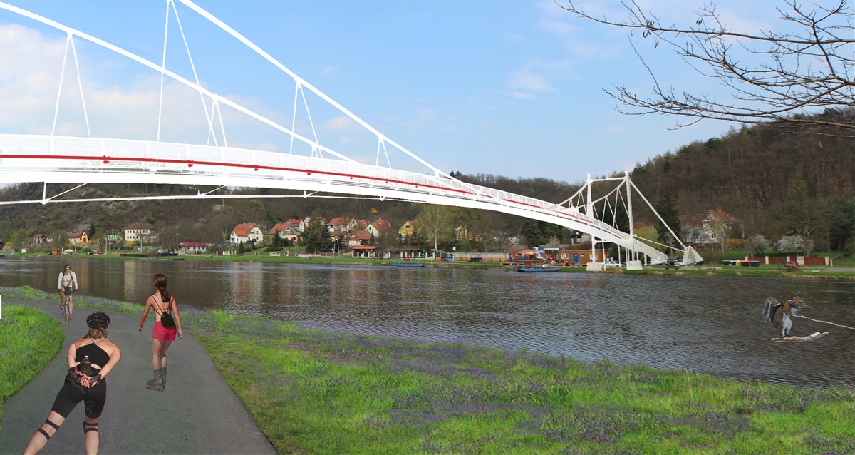
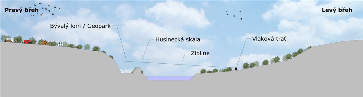
1. functional connection of the left and right banks of the river (determining locations for a new bridge, ferry)
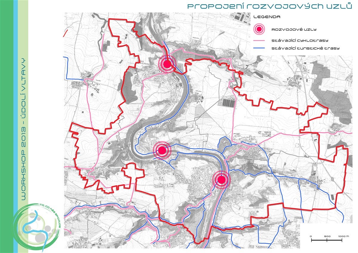
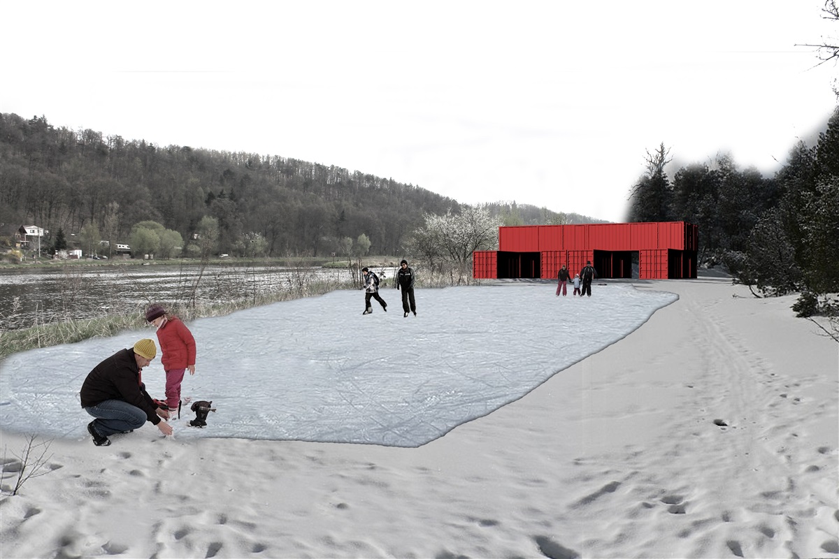
2. determination of development nodes and determine their functions
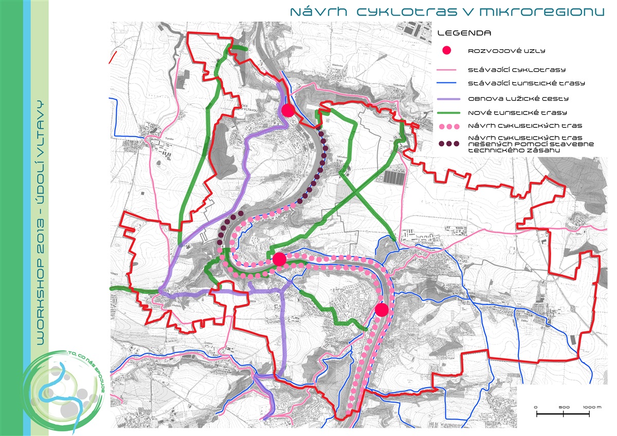
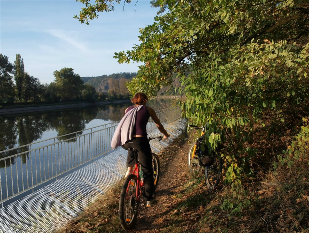
3. The interconnection of developing nodes - the hiking and cycling trails
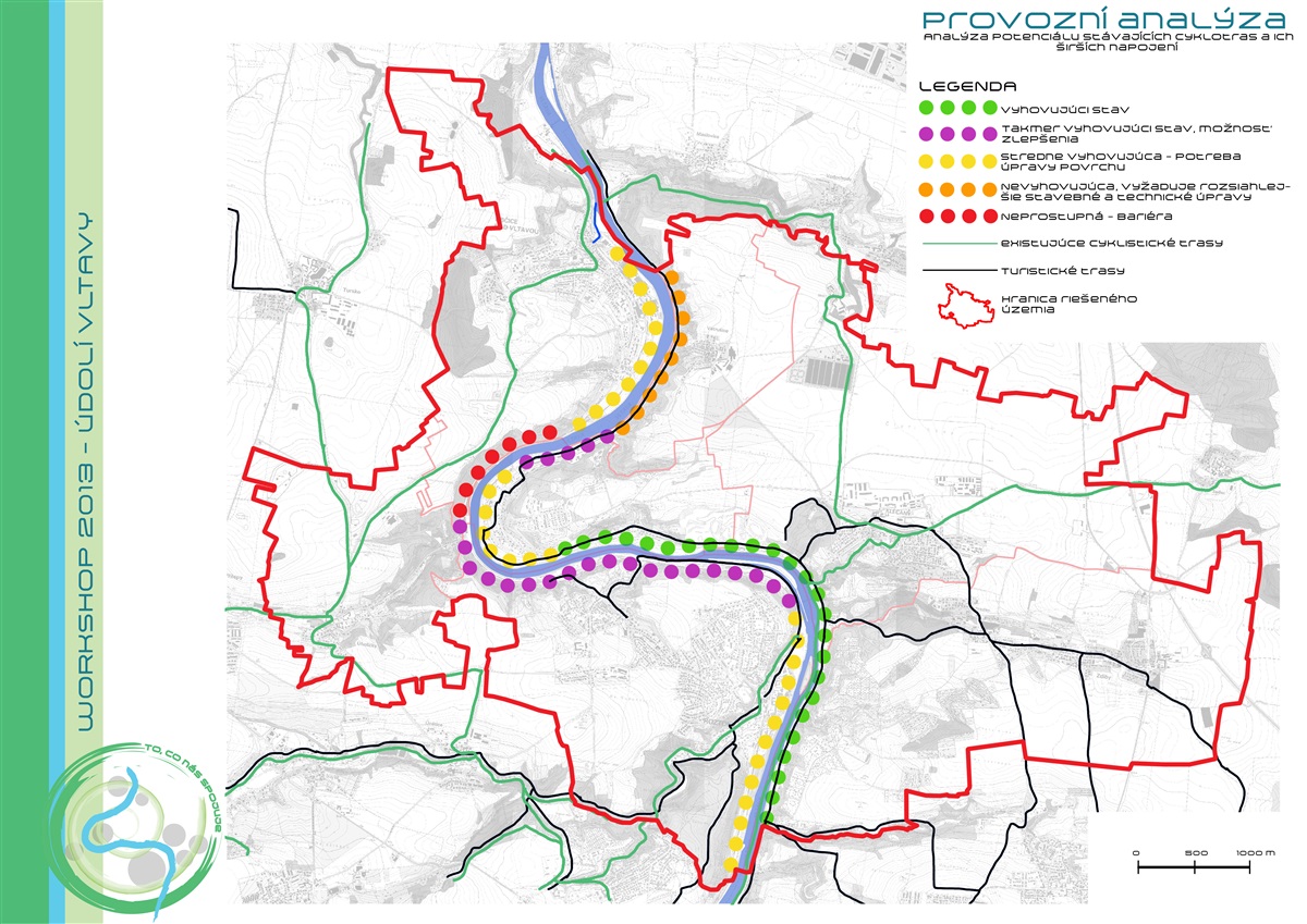
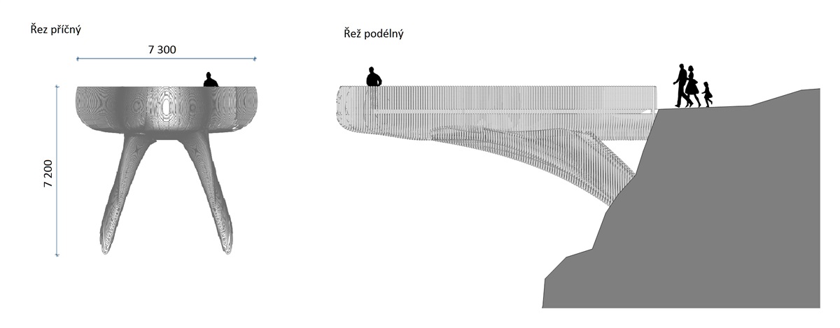
4. Modification of the surfaces of existing paths and paths newly created. Determination of places with difficult terrain that must be bridged consoles
5. Specific proposal in detail investigated areas
6. supplement the shores of unifying design furniture
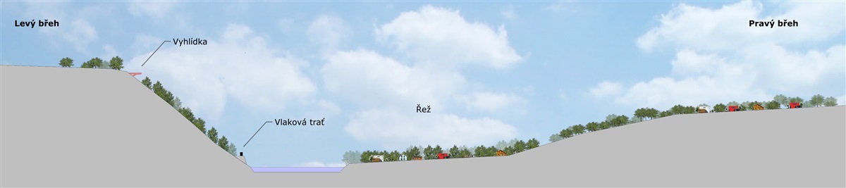
The project is based primarily on topography of strongly modeled landscape. Now the microregion is divided by Vltava riverbed to "Right" and "Left" bank. This creates two worlds that are currently connected only by the occasionally functioning ferry, which despite perform the connection is still a barrier.
The main feature of the proposal is to link plateaus and deepened river banks using newly created the hiking and cycling trails. These paths have been designed according to historical data obtained from historical maps. Paths are complemented by traditional fruit-tree-alley that divided the extensive field monocultures. Used old fruit-trees varieties and returns to the original scale of the landscape, increase its biodiversity and respond to the traditional form of the Czech countryside and its typical species.
In the western part of the micro-region was restored significant way, "Lužická trail" that operate in the territory since prehistoric times. Along the way are marked stops, where can the visitor learn about its long history, its purpose, formation and ultimately extinction.
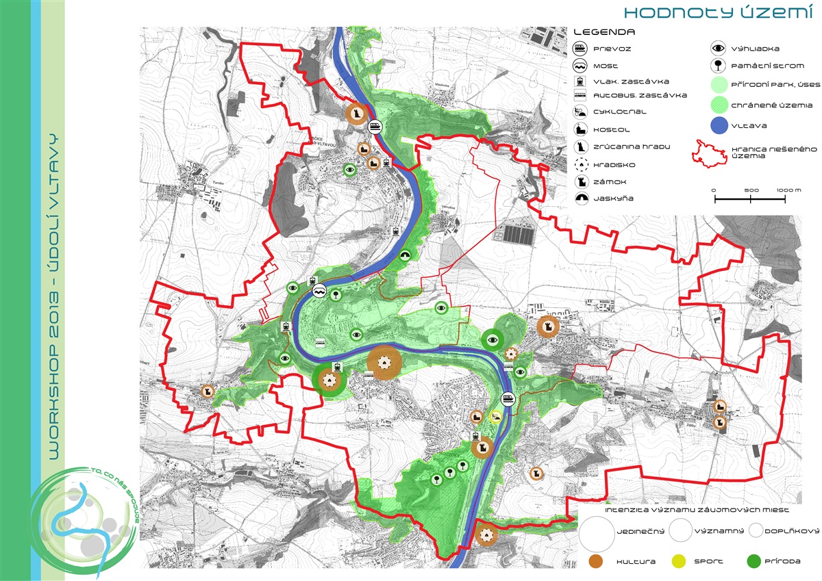
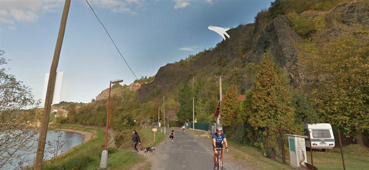
As a place of highest recreational potential was evaluated area around the river. Currently, the shores are connected by only two ferries and one bridge between the Nuclear Research Institute in Rez and the train station. Even the banks are now impassable on several places.
The project developed by:
Martina Havlová, Czech University of Agriculture, Prague
Zuzana Blašková, SPU, Nitra
Lukáš Makovička, Czech Technical University, Prague
Klára Skuhravá, Mendel University, Brno
Lenka Volková, STU, Bratislava